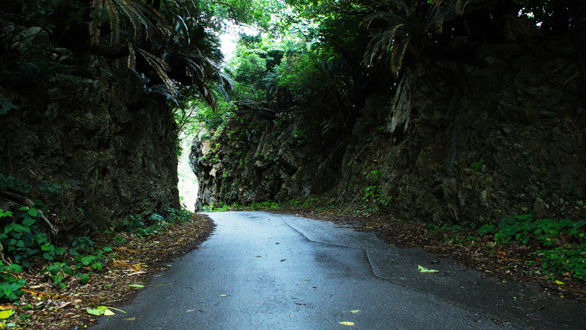
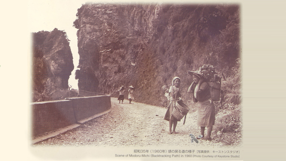
戻る道(もどるみち)
戻る道(もどるみち)は沖縄の自然に囲まれた雰囲気ただようスポットです。
道路なので、車内で「雰囲気すごいなぁ」と思いつつ車で通り過ぎる感じになります。
ですが、Uターンして近くの駐車場に車を止めて見学するのもありだと思います。
私も何回か凄いと思いつつ通り過ぎる事がありました!ですがここに沖縄の知らない歴史が残っていたなんてビックリです!
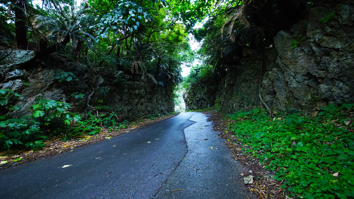
戻る道(もどるみち)の風景
戻る道(もどるみち)案内板
戻る道 Modoru-Michi (Backtracking Path)
宜名真集落(ぎなましゅうらく)の後方から約80mの断崖絶壁(だんがいぜっぺき)を登ると、辺戸上原とよばれた耕地(こうさくち)に適した土地があった。
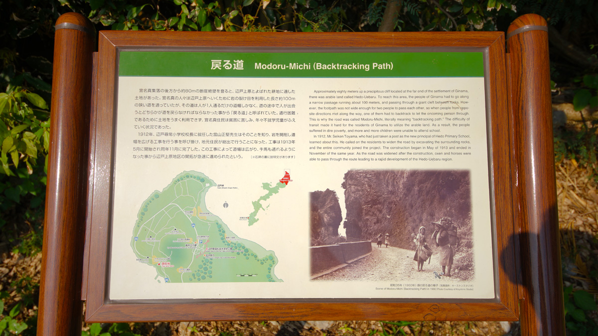
戻る道の案内板
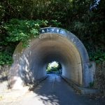
宜名真の人々は辺戸上原へいくために岩の裂け目を利用した長さ約100mの狭い道を通っていたが、その道は人が1人通れるだけの道幅しかなく、道の途中で人が出会うとどちらかが道を戻らなければならなかった事から「戻る道」と呼ばれていた。
戻る道(もどるみち)の案内板
通行困難であるために土地をうまく利用できず、宜名真住民は貧困に苦しみ、年々不就学児童がふえていく状況であった。
1912年、辺戸尋常小学校校長(へどじんじょうしょうがっこう)に就任した当山正堅先生(とうやませいけんせんせい)はそのことを知り、岩を開削し道幅を広げる工事を行う事を呼び掛け、地元住民が総出で行うことになった。
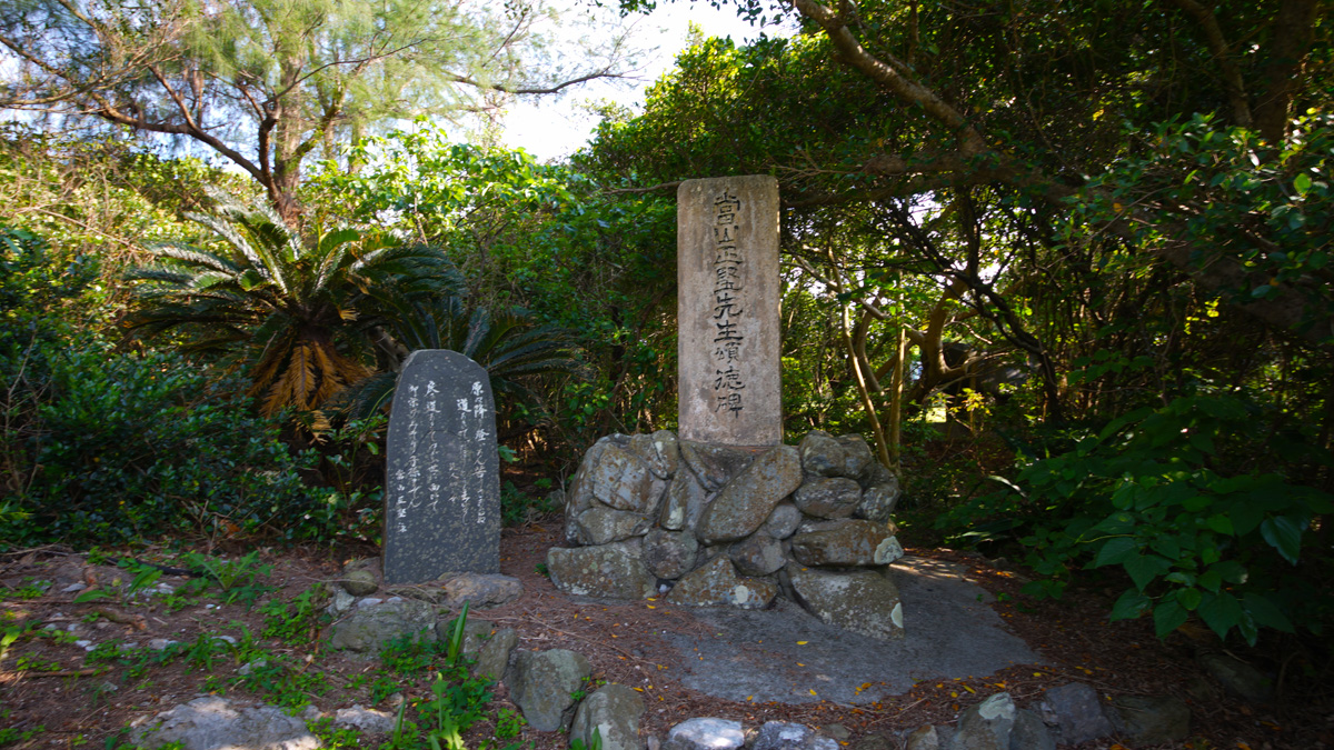
戻る道の石碑
工事は1913年5月に開始され同年11月に完了した。この工事によって道幅は広がり、牛馬も通れるようになった事から辺戸上原地区の開拓が急速に進められたという。
(※石碑(せきひ)の裏に説明文があります)
Approximately eighty meters ut a precipitous cliff located of the land if the tonen af Girama mere was arable land salted Hedo-Lenaru To reach this anes, the people of Sans had to go along narrow paesage nunning about 100 ms, and passing through a gant celt betek ever the footpath was wide enough for two people to pass each other, so when people tonippo site directions met along the way. e of them had to hacktrack to let the oncoming person through This is why the ruud was called Modoru Miche erally meaning tracktracking path. The difficulty of Transit made it hard for the residents of Ginama to ulize the arable land. As a reout the people suffered in dire poverty, and more and more children were unable to attend school
in 1912. Mr. Seken Toyama, who had just taken a post as the new propal of Hado Primary School learned about this. He called on the residents to widen the road by excavating the surrounding rocks and the entre community joined the project. The construction began in May of 1913 and ended as November of the same year. As the mad was widened after the construction, osen and horsee were able to pass through the route leading to a rapid development of the Hedo-Urbani region
茅打バンタの看板
茅打バンタ Kayauchi Banta
やんばる国立公園 Yambaru National Park

茅打ちバンタの看板
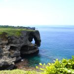
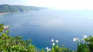
茅打バンタからの眺めは、沖縄で最も象徴的なパノラマのひとつです。
高さ80メートルの断崖の端にある展望台は、国頭の西海岸全体を見渡します。
内陸の森に覆われた山々と沖合のサンゴ礁に挟まれた長い緩やかな弧は、南方に位置する本部半島まで続いています。
西側に広がる何にも遮られない東シナ海の景色に沈む茅打バンタの夕日は絶景です。
「戻る道」
展望台から少し手前に戻ると、左側に山の狭い裂け目を通る道があります。
沿岸の道路が建設される前、この道は近くの宜名真と北にある耕地を結ぶ唯一の経路でした。
当時、裂け目は一人がやっと通れるほどの広さだったため、反対方向に向かう2人が途中で出会った場合、1人が後退しなくてはなりませんでした。
このことからこの道は「戻る道」として知られるようになりました。
これは通行に大変不便だったため、宜名真は孤立し、貧しさに苦しみました。
1912年、北にある辺戸小学校に新しい校長が赴任しました。
校長は赴任してすぐに生徒の欠席率の高さに困惑し、「戻る道」について知ると、直ちに地元住民を集めて道を広げ、生徒の通学を容易にしました。
1913年11月までには、道は双方向の交通が可能になるほど広げられ、かつて孤立していた集落は互いに行き来しやすくなりました。
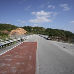
その後の数十年で、道をさらに広げるためにダイナマイトが使用され、現在の切り通しができました。
The view from Kayauchi Banta is one of the most iconic panoramas in Okinawa. The observation point stands on the edge of a sheer 80-meter cliff overlooking the entire western coast of Kunigami: a long, gentle arc with forested mountains inland and coral reefs offshore that stretches all the way to the Motobu Peninsula to the south. The unobstructed view west across the East China Sea makes sunset at Kayauchi Banta a spectacular sight.
The “Backtracking Path”
A few steps back from the lookout and to the left is a road that threads through a narrow cleft in the mountain. Before the coastal road was built, this was the only route connecting the people of nearby Ginama to the arable land to the north. In those days, the cleft was only wide enough for one person to pass through, so if two people traveling opposite ways met in the middle, one would have to backtrack out. As a result, it became known as the “backtracking path,” or modoru michi. This limited its use and left Ginama isolated and impoverished.
In 1912, a new principal arrived at Hedo Elementary School to the north. He was immediately puzzled by the high rate of absenteeism, and upon learning of the “backtracking path,” rallied local residents to widen the road so that students could get to school more easily. By November 1913, the cleft had been expanded enough to allow two-way traffic, bringing once-isolated communities closer. In subsequent decades, dynamite was used to widen the path still further, creating the space for the road that passes through today.
国村商工観光課
令和2年度 国頭村多言語解説等整事業
茅打ちバンタ(かやうちばんた)
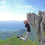
戻る道から上へ上がっていくと茅打ちバンタ(かやうちばんた)の絶景を望むことができます!
茅打ちバンタの断崖絶壁(だんがいぜっぺき)
| 観光名所 | 戻る道(もどるみち) |
|---|---|
| 住所 | 〒905-1422 沖縄県国頭郡国頭村宜名真 |
| 営業時間 | 見学自由 |
| 駐車場 | 有り(茅打ちバンタの駐車場) |